Tuesday, February 27, 2007

Day 38 : Bellingham to Byrness

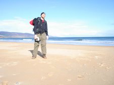
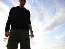
Wednesday 21st February 2007


Distance Walked: 16.6 miles
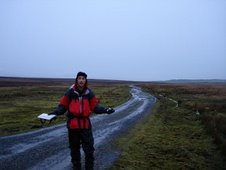
Start Time: 8:32
End Time: 14:24
Elapsed Time: 5:51
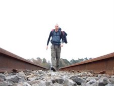
Weather: Foggy, then bright. Drizzle later.
Distance walked so far: 737.8 miles


Alfred Wainwright, the great overlord of British walking, believed that the Pennine Way should end at Hadrian’s Wall, and he was right. Instead it continues for fifty dreary miles until it nudges over the Scottish border and, if it didn’t, it’s almost certain that no one would choose to walk here. It is devoid of features and imagination.

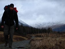
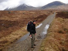
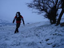
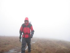
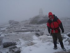
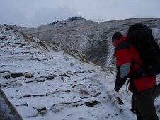
My morning mood lifted with the fog and, as the light burned through to reveal the views below, I was admiring the way the bright morning sun toyed with the low drifting cloud on the hills and the horizon. Oh, how pretty, they’re drifting this way. Oh, I can’t see anything. Oh, I’m walking through marshland. The path is submerged. I’m sinking. My feet are wet. Bugger.

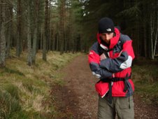
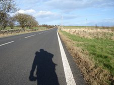
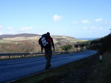
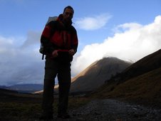
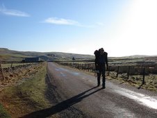
Walking is all about adapting plans to suit the conditions and my condition was that I was sick of the slow trudge through swamps. A detour down to the road from Abbey Rig and a few hasty minutes of replanning, and I was stomping along the lanes and tracks, free from the wetness and free from the Way. Not only was it liberating but it actually made sense, which for me was quite an achievement. Here the walking was smooth and easy, and led directly into the fringes of Kielder Forest, the huge, soulless expanse of firs, where the Pennine Way sheepishly rejoins me.

Kielder is manmade, and it shows. There's a lack of life and character, and the miles go by slowly. Finally I emerge onto a road through the trees. This is Byrness, a place that barely exists. If Wainwright had had his way there may be nothing here at all. Now there is a petrol station, a youth hostel, a hotel and the “First & Last Café in England”. I nip inside for a slow nibble of a chicken pie whilst the rain begins to fall outside, then head up to the Byrness Hotel where I’m initially greeted with desolation before eventually locating the entrance and being assaulted by three of the loudest, yappiest dogs you’ll ever see.

The standard of B&Bs varies greatly, but this feels mostly like someone’s house and my unwelcome presence is tolerated in small measures. I retreat to my room and think of Scotland, for tomorrow I will have walked through an entire country and will begin the assault on a second.


Song of the day:

The Shins
“New Slang”

I'm looking in on the good life /
I might be doomed never to find /
Without a trust or flaming fields /
Am I too dumb to refine?

Monday, February 26, 2007

Day 37 : Haltwhistle to Bellingham

Tuesday 20th February 2007


Distance Walked: 19.6 miles
Start Time: 9:04
End Time: 16:06
Elapsed Time: 7:02
Weather: Overcast but dry
Distance walked so far: 721.2 miles


I’m not carrying all my sins on my back but each day the bag seems to get heavier and the first hill of the day is always the steepest. Thankfully today’s hill takes me away from Haltwhistle and towards the final frontier, for here is the snaking expanse of Hadrian’s Wall, the most visible sign of the Roman occupation of these lands and the indication that my days of English walking are almost at an end.

The Pennine Way follows the line of the Wall for a few miles, and so do I, and the initial joy of such a unique experience is soon diluted by the huge, and wasteful, effort required to get through it. The wall leaps steeply up and down the hillocks that span the country and walking it is similar to the coast path in Cornwall, without the benefit of the reward of a view at every peak, for on each of these crests there is just another bit of wall and yet more desolate fields on either side. A long distance path follows the wall from coast to coast, and a more depressing, unrewarding walk it’s difficult to imagine. This is truly the domain of the masochist.

Leaving the crumbling edifice near Milecastle 37 it soon becomes apparent why the Wall was plonked where it is, for immediately beyond there is virtually no territory worth claiming. Shitty fields and shitty bogs and soulless woodland. What a tragic waste of an afternoon. Through unkempt farms and unkind forests. Depressed animals and depressing weather. There’s definitely a small leak, somewhere, in my left boot, and my sodden sock is as damp as my spirits by the time I arrive in Bellingham, a remote town which lacks network coverage, street lights and options for evening meals. I eat, where I sleep, in the Cheviot Hotel, with its basic facilities but friendly owners, and mingle with the travelling builders, salesmen and bomb disposers as we watch the broadcast of sporting events occurring somewhere out there, in the real world.


Song of the day:

Aretha Franklin
“This Bitter Earth”

This bitter earth, can it be so cold /
Today you're young, too soon you're old /
But while a voice within me cries /
I'm sure someone may answer my call /
And this bitter earth may not be so bitter after all

Day 36 : Alston to Haltwhistle

Monday 19th February 2007


Distance Walked: 14.1 miles
Start Time: 8:54
End Time: 13:49
Elapsed Time: 4:55
Weather: Overcast but dry
Distance walked so far: 701.6 miles


The beard, such as it is, remains. I’m hoping it may become a conversation piece, a modern day curio, a mechanism with which to integrate with the locals and to initiate sympathy when required. I am afflicted. A freak. It is my curse. My Merrick’s trunk. I name it Dufus, though tell no one of this.

The regulars at the bar of the Cumberland Hotel are clearly accustomed to stranger things though, and their brief acknowledgements of my presence mainly revolve around the fact that I’d best be taking the path along the old railway line if I’m heading northwards. Spent millions on it, they have. Millions. This fact is related with such passion that it’s clear that each and every one of them believes that those millions would have been rightly theirs if only the blasted path hadn’t existed. Damn the path. Damn it to hell.

For me, however, the path is a godsend. Following the route of what used to be the highest single-gauge railway in the country, the South Tyne Trail runs virtually parallel to the Pennine Way, but has the benefits of being flat, level and relatively straight. And though there is still a notion of a working tourist railway for the few miles to Kirkhaugh, the rails were under repair when I set off so I was safe in the knowledge that I would not be mown down when, like a wandering vagabond, I strode down the tracks whistling “The Littlest Hobo” and failing to invoke the spirit of some dustbowl-era drifter.

After Kirkhaugh, the railway line disappears, replaced by a succession of comforting surfaces. It’s a day without incidence and, apart from the trip under and along the Lambley Viaduct, almost devoid of highlights. It’s such a relief, though, to have easy day of walking, with no concerns about navigation or weather, that I find it all rather enjoyable, and hardly notice that, when I reach Haltwhistle, my destination is one of the gloomiest and sinister places I’ve yet encountered.

Haltwhistle proclaims itself as the geographical centre of Britain which, for someone who has just walked from one of the furthest corners of the country, has a certain appeal. The claim is based on maths and angles but, with my inherent distrust of geometry, I spend little time attempting to fathom it. I’m aware of other towns with similar claims, though I doubt any are as forceful in their proclamations, for Haltwhistle uses the mixed media assault of signposts, hoardings and bunting, all shouting the message that “This is the Centre of Britain”. This is reinforced by the Centre of Britain Hotel, Centre of Britain Launderette and Centre of Britain Fish & Chip Shop. Get the picture?

It’s hard to imagine a more unlikely town around which the rest of the country would revolve. Haltwhistle is odd. It feels like an outpost and, for the first time, I’m moving out of my comfort zone. I live in the Midlands. I was born in the North. Whilst there have been many areas that I have visited on this walk for the first time in my life, I had always been heading towards the familiar. Now I’m walking away from everything I know, and it’s beginning to feel like a real adventure.


Song of the day:

The The
“Lonely Planet”

I’m in love with this planet I’m standing on /
I can’t stop, can’t stop thinking of /
All the people I’ve ever loved /
All the people I have lost /
All the people I’ll never know /
All the feelings I’ve never shown /
The world’s too big and life’s too short /
To be alone…to be alone

Friday, February 23, 2007

Day 35 : Langdon Beck to Alston

Sunday 18th February 2007


Distance Walked: 16.7 miles
Start Time: 9:13
End Time: 14:17
Elapsed Time: 5:04
Weather: Perfect
Distance walked so far: 687.5 miles


The resistance starts here. From Langdon Beck the Pennine Way veers South West to encompass the delights of High Cup Nick, Dufton and Cross Fell, the highest point on the way itself. Though these are amongst the acknowledged highlights of the whole trek, the two days of intense walking in the wrong direction do not sit well with my ultimate goal, or with me, so instead I spend an enjoyable morning on the quiet lanes and tracks that skirt Cow Green Reservoir, heading directly for Alston, thus saving myself an extra days walking, and my legs from some unnecessary hills.

Alston claims to be the highest market town in England and, under today’s clear skies, it certainly feels like I’m walking in pure, mountain air. It’s liberating, too, to be free from the shackles of the Pennine Way, and safe from the moors that beckon on either side of the trail. Having scooted along the B6277, I drop down the valley and finally rejoin the Way at Garrigill from where it’s an easy few miles along the river to the “Pennine crossroads” of Alston.

This is clearly a popular place in season, with an astonishing number of pubs offering sustenance and accommodation. But it’s very much a stopping-off point. This is the heart of the Pennines, and from here it’s onwards into the remoteness of Northumberland and the Scottish border.


Song of the day:

Electric Light Orchestra
“Mr Blue Sky”

Sun is shinin’ in the sky /
There ain’t a cloud in sight /
It’s stopped rainin’ /
Everybody’s in a play /
And don’t you know /
It’s a beautiful new day

Day 34 : Bowes to Langdon Beck

Saturday 17th February 2007


Distance Walked: 22.6 miles
Start Time: 9:12
End Time: 17:12
Elapsed Time: 8:00
Weather: Overcast, then sunny.
Distance walked so far: 670.8 miles


It’s the spaces inbetween that are the most testing, the places that no one would normally choose to go. These are the places where there is nothing to see, where the paths unravel, the signs vanish, and the frustrations mount. The places that are plunged through, head down, until the reward of a new splendour appears. The curse of the Long Distance Walker is that the splendours can go by so briefly that the days become consumed with spaces. Sometimes these spaces inbetween go on for days. Today, it was only for a morning but the contrast was sharp.

The land north of Bowes has long been a warzone. Passing the remains of the old castle, the road plunges uphill through the MOD warning signs (“If you touch anything, you will die”) and up onto the moor, where the path is submerged in the marshland, and the walking is hard and heavy going. Slipping on a moist wooden bridge, I scatter gadgets into the bog all around. Disaster! Which one to save first? Can I survive without the GPS? Is it worth surviving without music, or photos?

Perversely, I pluck the iPod from the peat first and, satisfied that my priorities have been established, I slosh through the fields beyond the Grassholme Reservoir and down into the neat town of Middleton-in-Teesdale by lunchtime. Just when I’m thoroughly sick of the Pennine Way, it produces a delight, for the afternoon’s stroll along the River Tees from Middleton is an absolute beauty. It’s been surprising just how little I’ve seen of other walkers on the Walk but this is just about the most populated path I’ve seen so far, and rightly so. On a sunny Saturday afternoon, meandering west with the river through the fields and woods, with the fells of Upper Teesdale looming above, it’s a wonderful way to pass the time.

And the splendour, the reward after walking through all that space inbetween, is High Force, the dramatically named waterfall which is neither the biggest nor the highest in the country, but is hugely impressive nonetheless. The peaty brown water thunders over the edge, like bad beer, and is photographed from all angles by the weekend walkers.

“Can you take my photo, please” I ask of one. “I’ve walked here from Cornwall”
“No problem, mate” he says “I’ve walked here from the car park”

As always, I can’t linger long. Continuing onwards upstream along the path, suddenly I’m alone again. Back into space. As the sun sets, I arrive at Langdon Beck, which seems to consist of a road junction and a pub, and am met by the Support Crew who ferries us back to the comfort of Middleton. The morning fall has resulted in a worryingly stiff hip, and the increasing discomfort of the left shoulder is becoming a concern. Slowly, I unravel.


Song of the day:

Delaney & Bonnie
“Only you know and I know”

Only you know and I know
All the love we've got to show
So don't refuse to believe it
By reading too many meanings
'Cause you know that I mean what I say,
So don't go and take me the wrong way.
You know you can't go on getting your own way,
'Cause if you do, it's going to get you someday

Wednesday, February 21, 2007

Day 33 : Hawes to Bowes

Friday 16th February 2007


Distance Walked: 25.7 miles
Start Time: 9:20
End Time: 18:03
Elapsed Time: 8:43
Weather: Wet
Distance walked so far: 648.2 miles


The days of slogging through the snow, ice and rain have taken their toll on my nose and throat. I hack phlegm and splutter snot into the sodden grass as I slide through the fields between Hawes and Hardraw where, behind the Green Dragon pub, for a small charge, it’s possible to gawp at the highest waterfall in the country. Having seen its mundane wonder before, however, I hit the hills and begin the long, relentless slog up to the flat misty peak of Great Shunner Fell, the highest point of the Walk so far. Again, the stone pavement through the bogs enables a safe and rapid passage, though the low clouds prevent the kind of views that would make this a worthwhile experience.

The Pennine Way continues to irritate. I naively assumed that not only would the walking be a constant delight, but also that the infrastructure would be in place to remove any worries about accommodation or navigation. Sadly, not. The signposts are sometimes useless or non-existant. The Youth Hostels are closed (“Open all year, except Oct-Mar” actually means “Open half the year”, doesn’t it!), and many of the B&Bs have shut down completely. Worst of all, the walking itself is often unrewarding. Yes, there are highlights, but the Way insists on plunging through every single marsh or shitty swamp on the map, meandering in the most perverse way so that not a single bog is omitted. I get the rage.

As the rain begins to fall, I pass through Thwaite and then follow the Way as it winds up and around Kisdon Hill on the rocky path to Keld. Even the moist view of Swaledale below, with the classic layout of walls and barns, doesn’t lighten my mood as, from Keld, I reach Stonesdale Moor, where all notions of a safe passage disappear. Maybe in a different season the ground would be springy and fun, but in a wet winter it’s tiresome and treacherous. To my dismay, my boots, which have been so faithful to this point, are starting to allow water to seep through and, allied to the drenching from above, I’m thoroughly bedraggled by the time I reach the safety of the Tan Hill Inn, the highest pub in England.

Though time and the light are against me, I stop for a symbolic pint, before beginning the assault on Sleightholme Moor. Unbelievably, it’s even more deadly than Stonesdale, and there are moments when it appears I’ll have to retreat, but the rage takes over and, making myself as light as possible by thinking happy thoughts and whistling Disney songs, I plough straight through it all. Then it’s a long, cold, wet stomp through tracks and fields to the small but comforting village of Bowes where, thankfully, the Ancient Unicorn pub provides fantastic food and warm, friendly beds. At the end of an exhausting day, as my clothes stew by the fire, I can ask for no more.


Song of the day:

Memphis Slim
“Mother Earth”

Don’t care how great you are /
Don’t care what you worth /
When it all ends up /
You got to go back to mother earth

Day 32 : Horton-in-Ribblesdale to Hawes

Thursday 15th February 2007


Distance Walked: 13.6 miles
Start Time: 9:23
End Time: 14:02
Elapsed Time: 4:39
Weather: Very windy but dry.
Distance walked so far: 622.5 miles


I was drugged. Overdosed on the elements. High on the air, my mind lost to the light and the wind. That was no angel, just the Support Crew, back to lift flagging spirits. The night’s haven turned out to be the grotty Golden Lion Hotel, with its surly service, tiny rooms, plastic sheets and disturbing décor. The come-down was rapid and sobering.

There are only three things required for a good day’s walking: a consistent path, pleasant weather, and a view. Today provided none of these. For a start it was a gloomy day, and the hills and valleys which sparkled so brightly yesterday were deadened and dulled. But the real killer was the wind which blustered and blew, buffeting the bag and backside, making every step a lottery. Compounding this, the route largely followed stony, ankle-wrenching tracks and, despite my roars of frustration, progress was uncomfortably slow.

Thankfully it was a relatively short, uneventful walk and, once the climb up the flank of Dodd Fell had been accomplished, it was simply a case of picking a way through the remaining snow drifts on the top before descending sharply to the small, touristy town of Hawes. You can determine the popularity of a place from the size and quality of its Tourist Information Centre, and the TIC in Hawes is huge and shiny, with its own shop, museum and learning centre. On a cold day in February it’s largely deserted. I take my leaflets and slink off into another Yorkshire night.


Song of the day:

Brendan Benson
“What I’m Looking For”

Well I don’t know what I’m looking for /
But I know that I just want to look some more /
And I won’t be satisfied /
Till there’s nothing left that I haven’t tried /
For some people it’s an easy choice /
But for me there’s a devil with an angel’s voice /
Well I don’t know what I am looking for /
But I know that I just wanna look some more


Sunday, February 18, 2007

Day 31 : Skipton to Horton-in-Ribblesdale

Wednesday 14th February 2007


Distance Walked: 25.1 miles
Start Time: 8:49
End Time: 17:06
Elapsed Time: 8:17
Weather: Euphoric.
Distance walked so far: 608.9 miles


On a clear day you can see forever. Fashioning a route out of Skipton, through the conifers of Crag Wood and along the lanes to rejoin the Pennine Way at Airton, the Yorkshire Dales today were as vibrant and enticing as any scenery you could wish to encounter. This was a day for big skies and bright colours, for the bluest blues and greenest hues. And though the path by the river squelched with every step, it took me to Malham, through the rarity of mild crowds, and to the foot of Malham Cove, which loomed like a glacier, eating all in its path. The scale is astonishing and, indeed, this land was shaped by glaciers, with the Cove the remnant of a huge, ancient waterfall, and the limestone pavements on the plateau above carved by the weight of snow and ice that once sat here.

Through the stones I danced, down and around Malham Tarn, a limestone lake propped on the impervious rock below, and then a slog up the relentless Fountains Fell to reveal the first sight of Pen-y-ghent. This is why I walk. The effort is genuine. The experience is unique. The rewards are instant and unparalleled.

As the sun set, the peak, like a mighty ship ploughing through the land, shimmered and shone. How I yearned to climb it, but the night was coming and, for once, sense prevailed. Skirting the flanks, I headed for Horton and, descending from on high, I floated down into the arms of my angel. For a brief moment at least, all was well in the world.


Song of the day:

David Ackles
“Love’s Enough”

Cos everytime you fall in love /
That’s the one and only time /
It’s living through the final verse /
Of a one and lonely rhyme /
Cos you know this one will last forever /
And you turn and watch tomorrow drift away /
Cos tomorrow is forever /
And love’s enough for anyone today

Day 30 : Hebden Bridge to Skipton

Tuesday 13th February 2007


Distance Walked: 24.6 miles
Start Time: 8:37
End Time: 17:06
Elapsed Time: 8:29
Weather: Gloomy but dry.
Distance walked so far: 583.8 miles


The road pulls steeply out of Hebden Bridge on the way up to Heptonstall. Here the houses huddle together, hugging the hillside, and as the sun cracks the glowering sky, the blackened town glistens in the valley below. In its way, it’s as beautiful as anything I’ve seen so far. As pretty as Bath. As inspirational as Dovedale. Following the road above Hardcastle Crags, I rejoin the Way to wander through yet more reservoirs before the higher ground and dark peat bogs again take over.

This is Bronte country, and out on the wild windy moor I encounter two Japanese women, taking photos of a small, ruined farmhouse.

“Excuse me”, says one “Where is Top Withens?”
“You’re standing in front of it”
“Oh. Really?” she says, disappointed. “And waterfall? Where is that? It’s very important”
“It’s down the valley, just follow the signs” I say, and leave them, clicking.

For indeed the signs here are uniquely in both English and Japanese. Quite why that nation have taken so strongly to these tales is hard to fathom for, if I recall, “Wuthering Heights” is the story of a murdering psychopath and one woman’s inexplicable love for him. Maybe there’s something in the expression of repressed unfulfilled passion that corresponds with the Japanese psyche, but it is as unrepresentative of Britain then as Bridget Jones, Notting Hill and Eastenders are now.

Free from snow and ice, and with good visibility, the walking over the moors is fun and easy going. I sing “Tiny Dancer” to the wind and eat my third Snickers of the day. In most places the winding stone pavement plots a safe passage through the perilous blackness beneath and I’m soon back into fields and into the fringes of the Yorkshire Dales. Standing on the hill above Lothersdale, I confidently phone ahead to the B&B there, only to find that they no longer provide that service. Oh well. I try the B&B in the next town on the route, Thornton-in-Craven, and get the same reply. Ah. And the place in East Marton is full. Bugger.

Time for some hasty replanning. When in doubt, head for the biggest town on the map, so I leave the Pennine Way and scurry north-east, through Carleton-in-Craven (where I’m forced to help with some furniture removal in return for useless directions), before reaching Skipton just before nightfall. Chancing upon a row a B&Bs, I pick the one with the least tawdry façade and spend the evening planning a route back towards the recommended destination. The Pennine Way doesn’t seem to be doing me any favours so far though, and the urge to abandon it is strong.


Song of the day:

Coldplay
“Don’t Panic”

Bones sinking like stones /
All that we've fought for /
All these places we've grown /
All of us are done for
And we live in a beautiful world /
Yeah we do, yeah we do /
We live in a beautiful world


Day 29 : Hebden Bridge (Day of Rest)

Monday 12th February 2007

Distance Walked: 0 miles
Start Time: n/a
End Time: n/a
Elapsed Time: n/a
Weather: Gloomy and wet.
Distance walked so far: 559.2 miles


This is the story of a boy dissolving. With every step I’m ground away and dispersed. There is clarity now. I feel it. All that was superfluous is shod. The single purpose is all encompassing. I have one direction, and that is northwards, to the top. There has been struggle and moments of doubt. The past three days have been the most challenging of all, and today I rest in the home of my closest friend.

This is the chance to gather my breath and get my bearings. I purchase maps which will take me to Scotland. Supplies are replenished. The aches are tended but do not fade. My toes are numb. I don’t know whether this is good or not.

Whilst my face was turned, the beard appeared. It is as sporadic and unattractive as I suspected. I try to distance myself from it, and it from me. It is a separate entity. A companion, of sorts. For now its execution is delayed.


Song of the day:

Fairport Convention
“Who knows where the time goes”

Across the evening sky, all the birds are leaving
But how can they know it's time for them to go?
Before the winter fire, I will still be dreaming
I have no thought of time
For who knows where the time goes?
Who knows where the time goes?

Day 28 : Diggle to Hebden Bridge

Sunday 11th February 2007


Distance Walked: 17.4 miles
Start Time: 8:58
End Time: 15:00
Elapsed Time: 6:02
Weather: Urgh. Cold wind, rain, sleet and fog. Bit brighter later, though.
Distance walked so far: 559.2 miles


Curse you Joss Ackland! Curse you!

Everything I know, I’ve learnt from TV. School taught me how to pass exams. University taught me not to bother. But television filled my head with real knowledge. Johnny Ball, Mrs McLuskey and Norris McWhirter were my teachers. And television first introduced me to the concept of the end-to-end walk when, sometime in the late eighties, it beamed the image of a fat, ageing man slogging up a dark hill in the rain in an ill-fitting blue cagoule into my pre-pubescent goggle-brain.

Ackland and the John O’Groats walk. Of course, he wasn’t actually doing it. He was using acting. All lies. But the concept was real, and it was the concept that stuck with me, embedded somewhere, until somehow it emerged and insistently forced me to comply. And it was the image of that bloody blue raincoat that dominated my thoughts as I plodded up the road from Diggle in the fog and rain this morning, reluctantly dragging myself back to the Pennine Way and the dreary snowy peaks of yesterday’s misadventure.

The night’s rain had cleared some of the larger drifts and, as opposed to the virgin vista of yesterday, at least there were occasional boot prints and even bike tracks that I was able to follow when the path was obscured. Indeed, out of the mists soon emerged a herd of mountain bikers whose progress in these conditions was embarrassingly slow, but nonetheless amusing. I wasn’t the only hopeless case up here after all.

Having crossed the narrow misty bridge that swings high above M62, the Way eventually descends to the Roman Road and finally, below the cloud level, the valleys came into view, the sun, unbelievably, emerged, and I began to feel almost human again. Walking through the country certainly provides plenty of time to appreciate how the land shapes our lives. We are subject to it. The towns and cities are rare, sporadic outposts in a vast sea of earth and grass. The power is in the hills. The pylons and wind turbines are the modern signs, but the energy here once flowed down the valleys, into the mills and factories of Manchester and Sheffield, Leeds, Blackburn and Halifax. Here industry flourished. The revolution. This is the real heart of England, the engine that drove the land. You can feel it still.

I pass the Stoodley Pike Monument, another cock planted on another hill, and drop down the Calder Valley into the increasingly aspirational town of Hebden Bridge, where organic shops and right-on thinkers mingle with the tourists, hippies and junkies. The mills and factories are now luxury apartments. The canals are watery playgrounds. In such small ways, we try to reshape the world.


Song of the day:

Cat Stevens
“Sitting”

Life is like a maze of doors /
And they all open on the side you’re on /
Just keep on pushing hard boy /
Try as you may /
You’re gonna wind up where you started from

Day 27 : Padfield to Diggle

Saturday 10th February 2007


Distance Walked: 18 miles
Start Time: 7:45
End Time: 15:21
Elapsed Time: 7:36
Weather: Deep snow and zero visibility.
Distance walked so far: 541.8 miles


Holy fucking fuck! What an absolutely amazingly awful shit of a day. This was such an intensely miserable and shocking experience that at times I clutched it to my chest and tried to cherish every moment. This is what it’s like to be alive and in peril. For today I could have died.

I’d often thought it would be interesting if I could be a given a list, a top ten at least, of the moments when I had been closest to death. As far as I’m aware, I’ve been lucky. Death, particularly my own, is not something that has inconvenienced me, though maybe the list would indicate that I’ve had some narrow escapes that I was completely unaware of. The avoided crash. The bungling hitman. The antidoted allergy. I think today made it onto the list and, for now at least, it’s probably higher up there than I’d like to consider.

There’d clearly been another snowfall in the night but, as I trudged the miles back from Padfield to rejoin the Pennine Way, it was already turning to slush in the driving rain and my only real concern was the flapping wound in my overtrousers that I hadn’t quite got around to fixing. As I began to climb higher up Black Tor however the sleet was turning to snow, the dense clouds were moving in and the snow on the ground was above the boots. If there was a path it couldn’t be seen, and my feet were constantly sliding off the concealed rocks below the surface.

It was probably when I was crossing the ridge of Oaken Clough with the drifting snow, in places, above my knees that I began to worry. And when I reached the exposed upper ground it’s fair to say that panic was setting in. For this is a treacherous place even in the fairest weather. Huge grassy groughs with peat channels running between. In places a path has been marked out, with a snaking pavement to guide the adventurous walker. But, today, all was snow covered and virtually flat. The groughs were filled so that only a few grassy tufts remained, as I discovered when I strayed from the upper levels and sank up to my nuts in snow. Whilst this is certainly preferable to walking through bog, at least in a bog you have a chance of knowing where to aim for. Here nothing could be seen and, as I flattened myself to the snowy mounds and crawled onwards, the realization that I was lost and heading in the wrong direction crept upon my befuddled brain.

Oh.

Fuck.

The GPS saved me. With no landmarks against which to take a bearing, I desperately headed for the point where my pre-programmed route told me the path should be and, amazingly, after twenty leg-sapping minutes of floundering, there it was. Intermittent stone slabs and, beyond, the trig point at the top of Black Hill. With renewed hope I descended and, though there was stumbling and flailing, I finally dragged myself onto the tarmac of the lonely A635, as the infrequent cars sloshed by, indifferently.

From here the snow was less deadly and even though the trudge through the dull reservoirs of Wessenden seemed to go on for hours, I was giggling. I’d made it. Surely nothing would be as challenging, as fraught, as this, and I’d made it through. Maybe I could actually do this, after all. The boundaries between bravery and idiocy are hard to define, and very much depend on the end result of the action in question. History defines us. I’d been reckless, but prepared enough to survive. A brave idiot.

I slithered down the hill to Diggle (simply because I loved the name!) and, having found a B&B willing to take me in and dry my bedraggled belongings, I nestled in the bar of the Diggle Hotel and tried to pull myself together. There I read an article in a newspaper written by Paul Theroux in which he described the difference between holidays and travel. We go on holiday, he says, for fun. We travel, however, for experience. To learn more about different places and more about ourselves. Travel, he says, should never be fun.

Thanks for that Paul. I’m really travelling now.


Song of the day:

Tindersticks
“Can we start again?”

I’ve been wading through it /
Don’t you know it’s up to my neck /
And it won’t be long /
Till it’s over my head

Friday, February 16, 2007

Day 26 : Edale to Padfield

Friday 9th February 2007


Distance Walked: 20.2 miles
Start Time: 7:35
End Time: 14:50
Elapsed Time: 7:15
Weather: Snow. Fog.
Distance walked so far: 523.8 miles


The classic first day of the Pennine Way starts with a gentle upward slog through the fields from Edale towards Upper Booth and the hills above. This is popular walking country, but again I was alone, and with just a light covering of snow on the ground I tracked up Jacob’s Ladder into the icy wind and dense mist on the top. This is the start of the North. The differentiation is difficult to define. There are big hills in the South. There’s challenging weather in all parts of the country. But in the North, the hills are relentless, the weather is more extreme, more often. The red contour lines on the maps now proliferate. The North is hard and harsh. I walked through it.

Through Kinder Low, and past the frozen Kinder Downfall. Navigation was tricky in places, but my trust was in my little GPS friend, clutched tightly in gloved hand. Up onto the more exposed moor, where the snow was drifting and the wind drives into the face. To protect the peat bogs, and to protect the walker from disappearing into the peat bogs, a winding stone pavement has been laid in the more desolate areas and it’s relatively easy to make rapid progress. This path leads over the Snake’s Pass road and into Bleaklow. Here the scenery changes, although with reducing visibility all that could be seen was the nearest grassy hillock and the dark peat channel that runs through it.

This is one of the harshest, most unforgiving areas of the country. Under white skies, with the sinister mist dropping, it was easy to believe that people could vanish here. The ground, though, was largely frozen, and the danger of disappearing into the bog below was reduced. Snow-covered ice on the rocks was the biggest risk and, having crashed to earth on a number of occasions, my steps were increasingly wary. Finally, as the wind and sleet began to increase, I slid down off the moor towards the Longdendale Reservoirs.

I’d assumed that if any area of the country was geared towards supporting the needs of walkers, then this was it. But I’d learned whilst at Castleton that the recommended stopping point for the first night on the Pennine Way, the Youth Hostel at Crowden, was closed, so a three mile detour along the Trans Pennine Trail cycle path was required. This took me to Hadfield, the real Royston Vasey where, fittingly, there were no places for non-locals, so back I looped to Padfield. There, two of the three B&Bs were full, but I was saved from a night in a snowy field by the third, the White House Farm, where I attempted to dry my pants and gird my loins. Outside though, the snow was again beginning to fall.


Song of the day:

Radiohead
“How to disappear completely”

In a little while /
I’ll be gone /
The moment’s already passed /
Yes it’s done /
And I’m not here /
This isn’t happening

Thursday, February 15, 2007

Day 25 : Castleton to Edale

Thursday 8th February 2007


Distance Walked: 5.1 miles
Start Time: 11:15
End Time: 13:22
Elapsed Time: 2:07
Weather: Snow, above and below.
Distance walked so far: 503.6 miles


Essentially a rest day, this was supposed to be a chance to gather strength and resources before the initial assault on the Pennine Way tomorrow. Yet, between waking at 7am and breakfast at 8am, enough snow had fallen to close half the town, including the TIC, and left me bereft of info or confidence. A whole industry is supported by people’s desire to walk, study and experience the Pennine Way, with numerous books, maps and leaflets published, but I had nothing.

Despite the heavily falling snow, I decided to press on over the hill to Edale. Maybe the facilities there were more robust? There were no boot prints or tyre tracks on the ground as I tramped up the lanes and footpaths towards the ridge that separates Castelton from Edale. Who else would be out here, after all? There were no tourists, the locals had more sense than to go out, and any intrepid walkers would have had to have negotiated the tricky roads to get here in the first place. I had the place to myself.

Though the heavy clouds were low, it was just possible to make out the shape of the hills above. The paths were obscured however and, thinking I was heading for Hollin’s Cross, I instead ended up on Back Tor. Still, it was a chance to spend a fun few minutes sliding around on my arse as I admired the layout of the valley, before skidding down into the small town.

All too was closed except for The Old Nag’s Head pub, the alpha and omega of the Way. Having persuaded the surprised owners of the Mam Tor B&B that I really did want to use their facilities, I spent an afternoon by the pub fire absorbing as much information as I could about the days to come. If I’d stopped to think about what exactly I was attempting to do on this walk then I probably would never have got this far, but now the difficulties posed by the Pennine Way were hard to avoid. With the snow continuing to blot the features outside, the prospect of adventure was both daunting and enticing.


Song of the day:

Joanna Newsome
“Monkey & Bear”

The hills are groaning with excess /
Like a table ceaselessly being set /
Oh, my darling /
We’ll get there yet

Wednesday, February 14, 2007

Day 24 : Dovedale to Castleton

Wednesday 7th February 2007


Distance Walked: 29 miles
Start Time: 8:16
End Time: 17:33
Elapsed Time: 9:17
Weather: Frosty morning. Cold and sunny.
Distance walked so far: 498.5 miles


Dovedale is a magical place. The sides of the valley are so steep and sharp. The river so shallow. The light, flooding in, warming the hillsides. The fog drifting on the water. It’s a place of poetry and romance. Artists flood here, but none can truly capture such beauty. Today, I had the rare and joyful privilege of being completely alone for the entire journey from Dovedale to Hartington. If I remember nothing else from this walk, I’ll remember this. For the entire seven mile stretch I was enraptured, and commemorated this holy event with a warm sausage roll in Hartington, before climbing the lanes into the heart of the White Peak.

This is where the Limestone Way gets its name, for the white stone walls are dazzling in the morning sun. It all seems so perfectly arranged, that I barely resented the return to tarmac as I floated down to Monyash, with its clichéd duck pond and friendly café.

It was only when I missed the turning in Miller’s Dale that the day started to go wrong. Wasting a mile walking up and down the wrong hill wasn’t fun, but it was really when I unwisely consulted McCloy rather than followed my instincts that the afternoon turned into a stinker. There I was, happily following the Pennine Bridleway, a flat, stable route on the top of a ridge that I was pretty sure would take me straight to Castleton, when I glanced at the cursed book and inexplicably decided to descend into the valley to Peter Dale, which turned out to be a gloomy, boggy miserable rocky hole.

Having unnecessarily added at least three miles to my journey by the time I managed to rejoin the Limestone Way, the light was fading and my feet were aching as I scurried over the hills and down into Castelton. Mam Tor and its friends were foreboding silhouettes on the horizon, but all I could think about as I collapsed into the room at The Castle Inn (with its jacuzzi!) were my aching limbs, the prospect of the Pennine Way, and the severe warnings of snow that were making news readers and school children around the country so giddy with excitement. I was too tired to consider the implications.


Song of the day:

Tim Buckley
“Buzzin’ Fly”

Just like a buzzin’ fly /
I’ll come into your life /
I’ll float away /
Like honey in the sun

Monday, February 12, 2007

Day 23 : Uttoxeter to Dovedale

Tuesday 6th February 2007


Distance Walked: 16.3 miles
Start Time: 8:57
End Time: 15:22
Elapsed Time: 5:35
Weather: Cold and frosty, with light snow. Crisp and sunny later.
Distance walked so far: 469.5 miles


The enforced decision to cover the extra miles to Uttoxeter yesterday certainly turned out to be a blessing. The thought of having to do them in addition to today’s stint is almost too much to contemplate. When even the permanently chipper McCloy says that this section involves stomping through “endless fields”, you just know that it’s going to be monotonous.

And it’s not just that. I don’t know who touched the countryside last, but it’s a disgrace. You should see the state of some of these fields. They’re an absolute mess. If you want to know how many different varieties and textures of shit there are, then come and have a look at my boots, as I’ve been dragging most of it along with me all day.

What’s most annoying is that I’d really been looking forward to today’s walk, for today I was heading towards Dovedale, into the Peak District, and the first steps into a National Park on the route so far. What’s more, as I left Uttoxeter and crossed the River Dove into Derbyshire (briefly), I was serenaded by a light flurry of snow, to add to the crisp, frost-covered ground beneath. It was finally starting to feel like winter.

Unfortunately, it was also today that, having followed the Staffordshire Way to Rocester (pronounced “roaster”), I had my first encounter with the Limestone Way. Quite why it was decided that just when the environment gets more treacherous and confusing they should cease to provide adequate or accurate guidance from the waymarkers, I can’t say. What I can say is that whoever made that decision needs a damned good talking to. With force.

It’s bad enough plodding through endless fields, on rutted, boggy ground, without the added problem of constantly having to backtrack because either the signpost is missing or even pointing in the wrong direction completely. Maybe the Limestone Way is supposed to be a secret as, even though I was definitely mostly walking on the right path (having confirmed it on the GPS track log later), not one of the signs actually stated this until I’d virtually reached the A52, at which point everything brightened and the world was a beautiful place one again.

For there, on the horizon, was the familiar, romantic profile of Thorpe Cloud, standing like a sentinel as the gateway to Dovedale, to the Peak District and ultimately to the Pennines beyond. The pull towards it was irresistible and, though it resulted in a night at the opulent Izaak Walton Hotel rather than a more economical alternative, I convinced myself that the luxury of the evening was reward for the distance covered so far, and an impetus towards the hard days of hills yet to come.


Song of the day:

The Scientists
“Swampland”

In my heart /
there’s a place called swampland /
Nine parts water /
One part sand

Day 22 : Penkridge to Uttoxeter

Monday 5th February 2007


Distance Walked: 26.9 miles
Start Time: 7:53
End Time: 16:57
Elapsed Time: 9:04
Weather: Overcast. Brief rain shower. Then sunny.
Distance walked so far: 453.2 miles


I thought I was in fairly good shape before setting out on this trip. I’d staggered to the end of three marathons in the last three years, and had tried to maintain an active lifestyle, but the past three weeks have taken me to another level completely. I feel fitter, leaner and stronger than I ever have in my life. Posing in my pants in front of the mirror has never been so rewarding. And this was a day when the enhanced fitness came to the rescue.

I should’ve known that things were going too well, but the morning stroll out of Penkridge, alongside the canal and under the thundering M6 was really rather pleasant. It was hard to believe at times that this was such a heavily built up area, especially when the Staffordshire Way leads into Cannock Chase which is such a bizarre contrast to the surroundings that it feels like a Scottish Highlands theme park, complete with heather, wild deer and the first rain shower I’d experienced in two weeks.

A quick ramble through the grounds of Shugborough Park, and then east along the Trent and Mersey Canal, running parallel with the River Trent itself. This feels like a milestone, for I live by the Trent and, indeed, much of my training for this walk had been done running up and down its banks. Then it’s across the fields again, through Colton, and past Blithfield Reservoir. I’m ahead of schedule, heading for Abbot’s Bromely, home of the bizarre Horn Dance, and anticipating a relaxing afternoon.

When you approach a town and see a woman walking down the main street with a cow on a lead you know you’re in for a good night, so I saunter into the centre believing that my walking is done for the day and looking forward to working my way through the indecent number of pubs that are located in this tiny village. Unfortunately, for the first time during the walk, all the accommodation that I try is fully booked. Oh dear. I eat a pork pie in a state of semi-distress and realise that the only option is to press on to Uttoxeter, a further six miles away. Having been unable to pick up an OS Map for this section, I’m reliant on signposts and GPS, but thankfully the Staffordshire Way doesn’t let me down and I reach my goal as dusk descends, with feet crying out for respite. Perhaps some form of forward planning would help.


Song of the day:

Aimee Mann
“Wise Up”

It’s not what you thought /
When you first began it /
You got what you want /
Now you can hardly stand it, though /
By now you know /
It’s not going to stop /
‘Til you wise up

Day 21 : Wolverhampton to Penkridge

Sunday 4th February 2007


Distance Walked: 11 miles
Start Time: 8:44
End Time: 12:00
Elapsed Time: 3:16
Weather: Cold and clear.
Distance walked so far: 426.3 miles

Weekly Audio Update: Dave on The Steve Show - Day 21


It doesn’t take long to escape the Wolverhampton suburbs, and once again I’m walking down country lanes in the winter morning sunshine. This land is mostly farms and fields, and whilst the Staffordshire Way meanders through the turf, I stick to tarmac and cross motorway and canal, through Codsall and Brewood, and reach Penkridge by midday. We all have to deal with the consequences of our actions, and for me, today, it simply means that I’m weary. Weary from yesterday’s walking, and weary from the late night. And weary from the relentless daily effort. I settle into The Bridge Inn, one of two rather fancy pub/restaurants in the town, and attempt to will myself back to life.

I’m hoping I’ve still got the touch. I once, in order to avoid having to write a history essay at school, managed to convince an army of doctors (with their thorough, probing examinations) that I had appendicitis, which resulted in the useless organ being removed, despite the malady being a complete fabrication. Surely someone with such powers over their own body as to be able to make healthy attributes become withered could manage to breathe some enthusiasm back into this deflated soul. With beer and burger as my props, I set to work.


Song of the day:

Charlie Rich
“Feel like going home”

Lord, I feel like going home /
I tried and I failed /
And I’m tired and weary /
Everything I done was wrong /
And I feel like going home