Wednesday, January 31, 2007

Day 11 : Taunton to Glastonbury

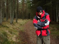
Thursday 25th January 2007


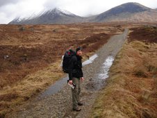
Distance Walked: 29 miles
Start Time: 8:02
End Time: 19:11
Elapsed Time: 11:09
Weather: Cold, bright and sunny.
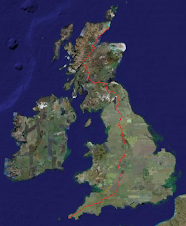
Distance walked so far: 251.2 miles


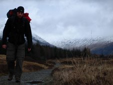
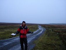
The Bridgwater and Taunton canal is particularly well named as those are the two towns that it connects. Today’s route follows the canal for the first few miles as it winds out of the suburbs of Taunton, between the industrial units and modern housing estates. The canal has a slightly different feel to it than the Grand Western. This is a working waterway. There’s more life here, both on and off the water and, whilst the wildlife is always a pleasure, it feels less magical and remote than the inactive stretch yesterday.

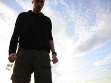
It should be pleasant and easy, but I just feel knackered before I even start. My feet are still aching after yesterday’s mileage and every step is a pain. As I leave the canal, and branch off to join the path along the River Tone my mood gets darker. Every day there’s a different injury, slowing me down. Today it’s my battered, flattened feet and my right shin which is now horribly swollen.

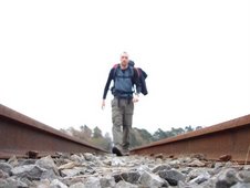
The river path isn’t helping. The whole area sits on reclaimed flood plains, with a grid system of water channels feeding out from the main course of the river, which means that a steady walking rhythm is impossible as every few metres there’s yet another stile or gate to flop over. Combined with the soft ground underfoot, and clinging mud, the effect is exhausting.

I trudge on, wallowing in my own misery, until I encounter a couple coming the other way.

“We have to ask”, they say, as one. “Where are you going with a bag like that?”
“Scotland”, I say.
“Oh, really? We’ve done that”

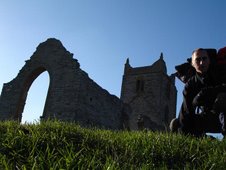
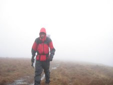
This is a first. People who have actually been through this themselves, and wish they were doing it again. I try to force a spring into my step and to remind myself how lucky I am, and eat my sandwiches on the top of Burrow Mump in the sunshine. The Mump is a large mound topped with the shell of a perfectly ruined church. The mound rises above the surrounding area of reclaimed swampland and the views on a clear, bright day like this are astonishing. In the far distance is Glastonbury Tor, my destination for the night. It looked a long way.

Maybe the reason that Glastonbury is believed to be a magical place is that it seems to float above the watery surroundings, which means that it must have been very hard to reach in ancient times. These days, for cars, there is the busy and narrow A361, whilst the walker is confronted with the King’s Sedgemoor Drain, a long straight channel which runs for 1.5 miles eastwards, before back lanes head towards Street, Glastonbury’s low class neighbour. It was only when I was half way along they Drain that I looked at the map and noticed that the path was actually on the other side of the water. Ah. This side leads to a dead end. Oh. Shit. I press on, hoping that there’ll be a way to cross the water, or somehow to rescue the situation but, no, I’m screwed. So back I trudge. It doesn’t make sense. There was a stile on this side. Why put a stile on this side if it leads nowhere?

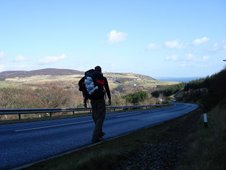
So, having wasted 1.5 miles of walking, by the time I get back to where I started I’m so sick of the sight of the Drain that I opt to complete the day by road and take my chances along the A361.

Mistake.

When the walk started, roads were avoided as much as possible, and when I had no choice but to walk on them it was with great hesitancy, an apologetic figure cowering from the oncoming traffic. Now I don’t give a flying fuck. The fucking cars can fucking get out of my fucking way. Bastards. I sway out of the way of lorries, but everything else can just fucking slow down and wait till they can move around me. It kind of works, but I’m dead on my feet by Greinton and, by the time the A361 becomes the even busier A39, it’s dark and I’m too tired to fight the flow.

A wandering detour through Walton is required, and then a slow painful plod through the back streets of Street, a town that seems to exist solely to house the workers of the all-consuming Clark’s factory that is so unavoidable here. By the time I’d made it across the river and up the hill to Glastonbury, my left knee was refusing to bend and all the blood in my feet felt as if it was seeping into my socks.

If I was ever going to quit, it was now. Lying under a blanket on the floor of the B&B, shivering from pain, shock and exhaustion, the idea of doing something a little easier (and more fun) seemed almost inescapably attractive.


Song of the day:

Townes Van Zandt
“Waitin’ around to die”

Sometimes I don’t know where this dirty road is taking me /
Sometimes I don’t even know the reason why /
Well I guess I keep on gambling /
Lots of booze and lots of rambling /
Well it’s easier than just waiting around to die

Tuesday, January 30, 2007

Day 10 : Tiverton to Taunton

Wednesday 24th January 2007

Distance Walked: 28.7 miles
Start Time: 8:26
End Time: 5:35
Elapsed Time: 8:51
Weather: Mainly clear, crisp and sunny. Invigorating.
Distance walked so far: 222.2 miles


There was a time when the British were so ridiculously confident that even the most outrageous schemes were accomplished before it was acknowledged how mind-boggingly ambitious they were. The Grand Western Canal is a rare example of a scheme that never quite came to fruition. The plan was to create an inland waterway route to connect the Bristol and English channels as a way to prevent the loss of shipping along the south coast. Only a small section of the canal was ever built before the advent of the railway made it obsolete, but for the walker it means that the first 11 miles of the route to Taunton are a breeze.

Then it all goes wrong. The canal just stops, suddenly, in the middle of nowhere, and after having enjoyed some mindless walking along the flat nature reserve that the towpath has now become, the remainder of the day is spent slogging along the lanes again. Somewhere along the way I pass into Somerset, but my feet feel flattened by the time they finally reach its capital.

Taunton is a neat and tidy little city but, after a full day of walking, the last thing that’s needed is to trudge through miles of bland suburbs before reaching the town centre. It’s dark and, once again, I’m limping by the time I’m finally done, but thankfully my one-woman back-up crew is in town and accommodation has been sorted, and even though the night is spent in the smallest hotel room you’ll ever see, there is a bath and a chance to tell tales of the journey gone and still to come.


Song of the day:

The Woods Band
“Dreams”

Dreams / Where can I buy them /
Please don’t hide them or I’m lost /
Dreams, oh, who sells them /
Go tell them /
I need them at all cost /
Without them all is lost and I won’t live forever

Day 9 : Crediton to Tiverton

Tuesday 23rd January 2007


Distance Walked: 16.9 miles
Start Time: 8:15
End Time: 14:56
Elapsed Time: 6:41
Weather: Beautiful. Cold but clear, bright and sunny.
Distance walked so far: 193.5 miles


“Hello. That’s a big bag. Where are you walking to?”
“Scotland”
“Really? That’s a long way”
“It feels like it”
“Are you doing it for charity?”
“Nope”
“Why are you doing it then?”
“Er…”

………………….

No child dreams of working in IT. Children dream of being heroes and adventurers, explorers and superstars. I was no different. I also dreamt of the day someone would open a Mousetrap theme pub. It would be fantastic. An entire pub dedicated to the fiendishly overcomplicated, Heath Robinson-esque board game, in which each trap would be set after a certain amount of alcohol had been purchased, up to the point when the ‘diver’ was set to spring and the cage would descend upon a random table, resulting in free drinks for the captured revellers.

My dreams never came true. Somehow, the last ten years of my life have been spent staring at a computer, in an office, in an industrial estate. It’s highly likely that the next thirty years of my life will be exactly the same. I’ve been told that I’m crazy to be doing this walk. I think I’d be crazy not to do it.

People get trapped. There are houses to buy, children to feed, careers to pursue. And somehow the point of it all is forgotten. Some people aren’t lucky enough to have a choice, but right now I do have a choice. I choose to see some of the country that I live in whilst it still might mean something to me. I choose experience over money. I choose dreams over reality.

And I’m still waiting for that pub to be built.

……………………

At last a view. After days of greyness, the sun was out and the sky was clear. After a quick jaunt eastwards through Shobrooke and Thorverton, the route turned north and the Exe valley was laid out below me. With a relatively short day of walking planned, the pace was easy and more rewarding as a result. After a first five miles of hobbling, I resorted to ripping off all the plasters swathing the toe and immediately I was able to walk comfortably for the first time in days. Vowing never to stick another plaster on my feet, I cruised on, joining the Exe Valley Way as it wound down towards Bickleigh, with it’s small but elegant castle and five arched bridge (the inspiration for “Bridge Over Troubled Water”, no less). The waters of the Exe were both high and troubled, and the path along the river to Tiverton was a mess of boggy clay, but the town was reached and accommodation found in good time. An evening of drinking and writing, of sausage and mash, and renewed confidence for the days ahead.


Song of the day:

Vashti Bunyan
“Diamond Day”

Just another life to live /
And a word to say /
Just another love to give /
And a diamond day

Monday, January 29, 2007

Day 8 : Okehampton to Crediton

Monday 22nd January 2007


Distance Walked: 22.7 miles
Start Time: 8:44
End Time: 17:12
Elapsed Time: 8:28
Weather: Bitterly cold and windy.
Distance walked so far: 176.6 miles


It was only when my freshly washed clothes were returned to me by the landlady at the Okehampton B&B that I realised that my pants were previously so stiff that they could’ve walked to Scotland by themselves, which, given the state of my limbs, would’ve been a great help. Instead I hobbled out of Okehampton as the glowering school kids flooded towards their lair, and crawled into Crediton as they spilled back out into the world again. Even the fact that I wasn’t stuck in the Monday morning traffic jam on the way to work (this is my work, at least for now!) couldn’t cheer my spirits.

It’s the pain, y’see. It consumes everything. Every step becomes a catalogue of sensations. Blisters below the toes, and blisters forming above. The twinge in the ankle. The throbbing knee. The slowly swelling shin. I cycle through the four limps at my disposal and try to decide which one is the least horrendous. At least it keeps my mind off the weather, for today it is cold. Really cold. And the wind forces itself through the layers and into the places where I don’t want places. Or wind.

When people heard about what I was intending to do, one of the main reasons for their incredulity seemed to be that I was choosing the worst possible time of the year to do it. And they were right. Winter in Britain can be grim. It’s not the snow, particularly, as that is increasingly rare these days. It’s the drops in temperature, and bitter winds, and mainly the overwhelming greyness of it all. Britain can be a miserable place in winter, and I was planning to walk northwards, straight into the heart of grimness.

But, so far, the timing of the stomp has only brought benefits. For a start, I have the paths and lanes to myself. I’ve hardly seen another walker so far, and the isolation is liberating. I fart and burp and piss freely, wherever I choose. I roll into towns and villages with the confidence that there will be room at the inn. No pre-booking for me, and with it the ability to tailor the length of my walks to match my appetite each day. And I’m able to drift into my own world, free from distractions.

For I’m in Devon now, and at this pace I’m able to slowly absorb the subtle changes in the scenery. There’s slightly more space here. Cornwall seemed squeezed. The hills were steep, the houses piled onto the cliff faces. Devon breathes a little easier. The slopes are more gentle, the gradients softer. The reddish hues of the earth here are more vibrant than anything I’ve seen so far. I relish the change.

I walk through the pretty village of Spreyton, and the procession of picture-perfect, thatched roofed cottages begins. Spreyton is the kind of place that competes for, and wins, Best Dressed Village awards. It must be a nightmare to live there. Then it’s more tarmac lanes, punishing the feet, until Crediton, which seems to consist solely of a long, drab high street with a succession of dour, dusty or derelict shops.

At the B&B, the owners are clearly veterans of catering for end-to-enders. They’ve seen it all before. They have one regular, they say, who is 83 and who recently completed the walk for the ninth time. Takes him nine months to do it, they say. What an idiot, he must be insane, I think, as I plan my route for tomorrow.


Song of the day:

Merz
“Dangerous Heady Love Scheme”

With the wind /
Through my senses /
Always with the wind /
Come dangerous heady love scheme

Sunday, January 28, 2007

Day 7 : Launceston to Okehampton

Sunday 21st January 2007


Distance Walked: 24.5 miles
Start Time: 7:06
End Time: 15:20
Elapsed Time: 7:10
Weather: Cold and sunny. Then overcast and wet.
Distance walked so far: 153.9 miles

Weekly Audio Update: Dave on The Steve Show - Day 7


I couldn’t leave Launceston fast enough. Skipping breakfast, I snuck downstairs and was out of the door and back on the road by 7am. I didn’t care how much my knee hurt. I just wanted to get away from that place. I’d missed the walking too, after my day of immobility. There’s a great freedom to it. And there’s a strange, simple purity to this particular pursuit too. The geography of the island provides a perfect structure for an end-to-end walk and, unlike in other countries, it’s easy to break it up into manageable sections without finding yourself stranded in a wilderness, without shops or pubs or accommodation. And in Britain, there’s a variety of scenery and terrain and weather and architecture that theoretically makes each day a new experience.

The Two Castles Trail follows an almost logical route along a succession of lanes, footpaths and villages, as it surges eastwards. Within an hour it crossed the bridge over the River Tamar, and finally I’d made it out of Cornwall and into Devon. At last, a second county. Making good progress, I reached The White Hart Inn in Bridestowe by lunchtime, so for once felt justified to stop for a pint and a rest, and to try to sort out my blistered little toe. Believing that Compeed plasters were the answer, I had swathed the little bastard in cushioning but the only effect seemed to be that the toe no longer fit into the boot and now the top of the toe was also beginning to blister. Sweet.

People are curious, and curious people even more so, and the sight of a large bag being carried by a dirty, limping idiot certainly catches the eye in these kind of places. Having discussed my ridiculous trek with the curious drinkers at the bar, and re-annointed my aching knees, I set off again towards Okehampton. By now the sky was darkening, and my limp was become more pronounced and the last thing I needed, particularly after my Bodmin experience, was a trek across the edge of Dartmoor, which the Trail was suggesting. Thankfully I was saved by The Granite Way, a long, flat stretch of tarmac that runs parallel with the railway line, forming part of the National Cycle Network, which carried me over the Meldon Viaduct and straight into Okehampton.

So, a week's walking completed then, but there's definitely concern about the growing discomfort. I knew that there'd be problems, but I never imagined that my legs would be dissolving quite so soon.


Song of the day:

The Decemberists
“As I Rise”

I have come a few miles /
I got blisters on my slippered feet /
As I rise, as I rise /
California’s ok /
But I think I might stay in the shade /
For a while, for a while


Tuesday, January 23, 2007

Day 6 : Launceston (Day of Rest)

Saturday 20th January 2007

Distance Walked: 0 miles
Start Time: n/a
End Time: n/a
Elapsed Time: n/a
Weather: Cold and sunny. Then wet. Hail.
Distance walked so far: 129.4 miles


Launceston is a hole. Or rather, a hole with a hill. And on the hill, there sits a ruined castle. The castle is a round, pretty little thing, but not something in itself that would draw the crowds, which is probably why it was closed for winter. Having limped up the hill, and determined not to waste the trip, I went for a full tour of the town. Two minutes later, I did it again, just to be sure. Oh well.

I stocked up on bandages, creams, gels and drugs with which to admonish my aching limbs, and finally tracked down the Tourist Information Centre, which predictably was also closed. My plan for tomorrow was to walk the Two Castles Trail, another of these fabricated long distance routes that use occasional footpaths, but mainly country lanes, to encourage the tourists to wander through the splendour that is the countryside. This particular trail joins the towns of Launceston and Okehampton, or rather the castles within, but no one in Launceston seemed to be aware of its existence or had any information about it. I hobbled back down the hill to the pub and applied my unguents with fanatical devotion, speaking incantations to increase the potency. Then I waited for the healing to begin.

The good thing about The White Horse Inn is that the food they serve is fantastic. Go there for the food, certainly. Then leave immediately, for, unfortunately, the accommodation is located directly above a fault line, a crack in the fabric of the earth, out of which pours the foulest, loudest music known to man. And Saturday night is karaoke night. The only reason to attend is that you know that, no matter how tuneless the contestants, the sound is so deafening that you will lose consciousness before brain damage sets in.

Sleep wasn’t really an option, which is why I was more than a little disappointed when, as the music finally stopped sometime around 1am, a couple bundled upstairs into the room next to mine and proceeded to have a loud drunken argument before, DURING, and after sex. They then both threw up, and immediately went straight back at it. I don’t know if you’ve ever heard anyone having sex (and I admit there’s a certain thrill at the sheer unexpected naughtiness of it all, like you’ve caught a glimpse of the Queen on the toilet) but the excitement is soon replaced by a grim tedious exasperation, especially when it’s obviously so inexpertly executed and, moreover, unappreciated by both parties. I piled the pillows on my head and held my breath until I passed out. This wouldn’t happen to Michael Palin.


Song of the day:


Dead Kennedys
“Too drunk to fuck”

But in my room /
Wish you were dead
You ball like the baby in Eraserhead /
Too drunk to fuck /
Too drunk to fuck /
Too drunk, to fuck /
It's all I need right now /
Too drunk to fuck

Day 5 : Dunmere (nr Bodmin) to Launceston

Friday 19th January 2007


Distance Walked: 35.5 miles
Start Time: 8:57
End Time: 19:10
Elapsed Time: 10:12
Weather: Strong winds. Rain. Poor visibility on moor.
Distance walked so far: 129.4 miles


I don’t know if any of you were thinking of carrying a 12kg bag for 35 miles over a desolate boggy moor and dark country roads in gale force winds and driving rain with zero visibility and aching legs having walked 100 miles in the last 4 days? If you were, my advice to you is - don’t. It is FUCKING CRAZY. At first I thought that Bodmin was a pussy cat. In fact, it’s the kind of cat that shits in your mouth when you’re asleep and then, when you wake up, it claws your tongue off.

The day before the walk started, as I was driving down to Cornwall, I got a phone call from someone I used to know who’s become something of a minor celebrity, asking me to have a small cameo in a radio show he was about to start. When I told him about what I was about to do, it was suggested that the walk was incorporated as a running feature. Now, this is all very well, but suddenly it’s a public event. Previously, barely anyone knew what I was doing. I wasn’t raising money for charity; no one was counting on me to complete it; no one would know if I finished or not; if it all got too much I could just stop and no one would be any wiser. And when you’re stuck on Bodmin Moor in terrible conditions, desperately searching for a footpath that seems to be somewhere just beyond the next few treacherous bogs, you begin to regret the lack of easy escape route from this folly.

Today the weather was bad. Very bad. Elsewhere in the country, buildings were falling, boats were sinking and people were being winched to safety. And this was the day that I decided to cross Bodmin Moor, make a couple of wrong turnings, and then walk for two hours in the dark and rain on one of the narrowest main roads you will ever see. Nice one Dave. Well done.

The Camel Trail is actually a lovely walk alongside the river on a flat comfortable path through attractive woodland, and I kept up a good pace for most of the morning. Leaving the trail, the road winds up the steep hill to Saint Breward, which may be the highest town in Cornwall, or somesuch stat. Thankfully, it had a shop which sold OS maps, so I was able to grab the map for Bodmin moor, without which the day would have been even more disastrous (if that is possible).

Now, rushed though the preparations for this walk were, I did manage to sort some of the essentials. I’ve worn glasses and contact lenses for more than fifteen years, so when I decided to actually go through with this thing I realised that it would be something of a disadvantage to be confronted with bad weather whilst wearing either. Today was the kind of day that I would’ve dreaded. So, just after Christmas, I took the plunge and got my eyes lasered. A momentous decision, and obviously I was nervous. I asked the surgeon if I’d be able to play the piano after the procedure. “Yes”, he replied “You’ll be able to play perfectly”, which was nice cos I couldn’t play at all beforehand.

So it was with my new laser eyes that I saw that my decision to persist with the climb up Brown Willy, the highest mountain in Cornwall (and most ridiculously named) was something of a waste of time as there was zero visibility at the top. That I’d wandered into a quagmire and would have to backtrack hurriedly before I was absorbed as a new bogman for future Tony Robinson’s to gawp at. That I’d ripped my waterproof trousers on a barbed wire fence when trying to vault my way eastwards to safety. And that I’d somehow missed the road turning that would’ve taken me straight to Launceston on a flat, quiet road by the river and was instead condemned to six miles of walking up and down hills in the dark on a narrow A road with busy rush-hour traffic armed only with a flashlight and a limp. Nice one Dave. Well done.

Vowing to take my first rest day tomorrow, I finally reached Launceston and collapsed into the first accommodating pub, The White Horse Inn.

Sixty-six miles of walking in two days.

Feet crushed.

Knee on fire.

All is pain.


Song of the day:

Piano Magic
“You can never get lost when you’ve nowhere to go”

I know nothing of tides /
And I’m confused by the stars /
But you can never get lost /
When you’ve nowhere to go

Day 4 : Truro to Dunmere (nr Bodmin)

Thursday 18th January 2007


Distance Walked: 31.2 miles
Start Time: 9:07
End Time: 17:34
Elapsed Time: 8:27
Weather: Grey. Cold. Miserable.
Distance walked so far: 93.9 miles


Despite being the supposed capital city of Cornwall, Truro is a small, squat place, cascading across the junctions of the rivers Allen and Kenwyn. There is, however, a good selection of shops to replenish supplies, so before setting off in the morning I made sure that my flapjack levels were sufficient, and marched off northwards alongside the river towards Idless Wood. My general aim on the walk is to cover as many miles as possible each day, but also to end each day in a decently sized town, the premise being that it would remove the need to book accommodation in advance and increase the likelihood of finding decent food and supplies each day. The suggested route plan from Truro says that today would be a gentle 13.5 miles to Indian Queens. Recklessly reckoning that I could cover three days worth of walking in two days, I increase the pace and hope to reach the Bodmin area by nightfall. This may have been a mistake.

With my annotated map clutched firmly in my hand I made an almost perfect exit from the city and was on my way into Idless Wood. Run by the Forestry Commission, I’m sure it’s a delightful place in the spring and summer, with a multitude a walking paths through picturesque woodland trails. In a wet winter it’s hard to keep your feet long enough to admire the scenery. And anyway, all I was interested in today was mileage. There would be other days for scenery and a leisurely pace. I put my head down and headed back to the country lanes, skirting the A30 once again. Through the villages and past the farms I flew, through all manner of endearingly ludicrous place names. Cockmunch, Flange Panel and Parp they may have been. Or not. Through the quarry town of Indian Queens (a genuine name) with its Gnome World attraction and owl sanctuary, and on again. The pre-programmed route in the GPS was telling me the destination wouldn’t be reached before dark and a mild panic was beginning to set in.

I headed up and over the old fort formation of Castle-an-Dinas from which the views are supposed to be spectacular, but on a grey day like this it was difficult to see beyond the busy main road below. Clearly the farmer who owns the land below is not too happy about the fact that a public footpath runs through his property as he’d decided to place a herd of particularly frisky bulls in the field and as they darted towards me on the descent I was forced to make a comically inept escape over the barbed wire fence.

Maybe that’s when the knee finally gave up, or more likely it’s just an accumulation of abuse, of going too far, too fast, on too much tarmac, but it soon became apparent that I was unable to bend it fully and it was extremely painful to the touch. And I’d also developed my first blisters of the trip, underneath the little toe of my left foot.

With torch strapped to my head I finally approached Dunmere, a village straddling the Camel Trail, my route for tomorrow, which is a long flat walking/cycling trail that follows the route of the River Camel northwards towards Saint Breward and the moor. Thankfully I tracked down a B&B in an old lodge house, which was run by a delightfully eccentric looking man who looked like a Captain who’d lost his army and didn’t quite know what to do with himself. He also had a peculiar limp, and as I hobbled up the stairs behind him I hoped he wouldn’t notice my similar affliction and think I was mocking him, if only because I doubted I’d be able to find another B&B if he kicked me out.

I swiftly doused my swollen knee with deep heat, which seemed to do nothing but make my leg unbelievably hot. And you wouldn’t believe how much vaseline I had to smother on my nethers to soothe my frictioned arse. And somehow I’ve developed a massive black bruise on my inner thigh. What the hell is going on? I spent the evening in the pub, overlooking the trail, drinking as much muscle relaxant as I could. I’m going to need it.


Song of the day:


Jackson C. Frank
“Blues run the game”

Try another city baby /
Another town /
Wherever I have gone /
Wherever I’ve bin and gone /
The blues come following down


Sunday, January 21, 2007

Day 3 : Tregathenan (nr Helston) to Truro

Wednesday 17th January 2007


Distance Walked: 21.5 miles
Start Time: 9:11
End Time: 15:54
Elapsed Time: 6:43
Weather: Grey. Cold. Miserable.
Distance walked so far: 62.7 miles


This is where the reality kicks in. Anyone can walk along a path for a couple of days. Not everyone can walk for day after day, when there is no path, along road edges, fields, moors, hills and mountains. That’s the challenge here, and it hits me almost immediately today. On a shitty grey day, I realise the value of preparation. Of paths. And maps.

You see, I don’t have a map for today’s route. I meant to get one, but I didn’t have the chance. And this causes problems.

Let me tell you about GPS devices. I bought a Garmin GPS device for this walk. The GPSmap 60CSx. It’s great. A neat little black gadget. It will tell me where I am and it will save me life. Of that I’m certain. What’s not great about it is that the digital maps that are supplied with it are so ridiculously basic that they are fundamentally unusable. You can however purchase, for a further £150, the Topo software which provides more detailed maps, for a limited area, to be downloaded to your device. You can also purchase the Memory-Map software which will allow you to pre-plan a route and export this to your device. The software for the whole of Britain costs £200. The device may save my life, but I was beginning to wonder whether that would be a wise financial investment. So I just went for the Memory-Map stuff. This means that I vaguely know which way I should be heading, without knowing precisely where I am or which road/path I should be following. This causes problems. And I experienced most of those problems today.

Today was spent pounding along tarmac, on a miserable wet day, walking on narrow Cornish lanes. With Cornish cars. And Cornish drivers. I felt completely unwanted. The only thing visible from Cornish Lanes are hedges and the occasional cow. The route suggested by McCloy mentions pleasant footpaths and country routes, but the footpaths that I found were impassable waterlogged bogs. Without an OS map I wasn’t entirely sure which country lane to take at each junction, and found myself dragged imperceptibly towards the foreboding A30. The A30 is a great road. Ploughing straight through the heart of Devon and Cornwall ,it plunges right to the very tip of the country; miles of slick, unadulterated, smooth tarmac, taming the wild moors and hills that surround it. It must be bliss for the end-to-enders who choose to travel on wheels. For walkers it is a constant torment. All surrounding roads are sucked towards it, and it is virtually impossible to avoid crossing it an some point of the walk. It's a constant reminder to the walker of the slow and antiquated progress they are making.

I finally worked out where I should be going but the necessary detour added unwanted mileage to the day and by the time I finally reached Truro my feet felt completely flattened. I wearily admired the cathedral, though fittingly it is encroached on all sides by a ghastly collection of shops and distasteful concrete monstrostities. The Phones 4 U salesmen next door are the modern clergy. Maybe if the Church rebranded as the ChristFaith Warehouse they'd start pulling in the punters again.

Booking a B&B through the Tourist Information Centre, I also purchased as many of the relevant OS maps that I could find and spent the evening tending to my aching joints and planning the route for tomorrow. I don’t mind walking, but it’s the meaningless extra miles that really get me down.


Song of the day:

Andrew Bird

“Headsoak”

I was walking /
With my feet /
A disposition /
Fell over me


Day 2 : Penzance to Tregathenan (nr Helston)

Tuesday 16th January 2007
Distance Walked: 22.4 miles
Start Time: 9:30
End Time: 17:06
Elapsed Time: 8:06
Weather: Cold and sunny early on; overcast and drizzly later
Distance walked so far: 41.2 miles


Penzance looks tired. An attempt has clearly been made to smarten the edges, but at heart it’s a fishing village that entices summer visitors with its relatively large selection of shops and restaurants. In winter it’s largely dormant. I walk along the seafront and follow the curved shore of Mount’s Bay eastward. As the morning sun emerges it becomes impossible to look away from the growing silhouette of the island castle across the bay. It seems impossibly perfect from this distance. A fairytale castle on a fantasy island, reached by a magic causeway. Or a ferry. Of course, at this time of the year, it’s closed. Taking the opportunity, with the elderly dog walkers, to walk along the beach, I symbolically dip my boots in the sea. Soon the end to end route will head north and won’t encounter the coast again until northern Scotland, if I make it that far.

The Coast Path emerges again and dips in and out of coves and bays. The scenery is unquestionably fantastic, and I realise that the first two days of this walk are almost certainly spoiling me. Here there’s always something to look at. It won’t always be the case. At regular points the walker is confronted with a choice of routes; up and over the cliffs or along the shore. After a couple of misjudged choices along the lower route which resulted in scrambling over rocks I realised that I had enough of a challenge ahead of me without having to put myself through such an obstacle course.

On the cliff tops the senses are assaulted by field after field of rotting cabbage stalks, and the accompanying stink. Fishing isn’t the only industry in this part of the world. With the wind at my back I speed on and finally reach Porthleven, and my first pub of the walk, The Harbour Inn, which disappointingly is a modern, tacky and sanitised affair. Still, I reckon I’ve made good time and have plenty of opportunity to reach my B&B for the night in Helston before the light fades, so I enjoy a leisurely pint whilst the TV jukebox spews Sam & Mark’s classic cover of “With a little help from my friends” into my eyes.

It’s only when I’m back on the road that I realise that the B&B isn’t actually in Helston. It’s further than that. Over a couple of really steep hills. I consider walking to Helston anyway, but decide against it. I’m not confident enough yet to just turn up somewhere in the hope that I’ll be able to find accommodation, even though my destination, Tregathenan, is in the middle of nowhere and would almost certainly mean no dinner for me tonight.

I plough on as the dusk falls. Pounding up mud strewn lanes, I walk past herd after herd of miserable looking European youths coming the other way. Bus loads of them. Stopping to chat with one of the drivers, it turns out that they’re the workforce who pick the daffodils that are emerging at this time of year.

When I finally reach the B&B in darkness, it became clear that I had nothing to worry about. Ian and Liz were delightful, allowed me to get cleaned up, ran me back to the good pub in Porthleven, The Ship Inn, and then took me to their regular Tuesday night quiz at The Crown Inn. Whilst I’m dubious that we weren't cheated out of a victory, so pleased were they with our second place that the packed lunch in the morning is wrapped with a tenderness that I will do well not to expect from all my future hosts.


Song of the day:

Bill Fay
“Omega Day”

Inside a bar of a sleeping town /
there lay a sleeping man /
he wore a frown
A stranger woke him /
he looked around /
then he spoke /
I wrote it down


Thursday, January 18, 2007

Day 1 : Land's End to Penzance

Monday 15th January 2007


Distance Walked: 18.8 miles
Start Time: 9:25
End Time: 15:16
Weather: Cold and sunny early on; overcast and drizzly later
Distance walked so far: 18.8 miles

Weekly Audio Update: Dave on The Steve Show - Day 0


"So, you're really doing it then?"
"Yep"
"It's not a wind up?"
"Nope"
"Bit of a cry for a help, isn't it"
"Possibly"
"Y'know, if you're lonely, you just need to say"
"Thanks"
"You don't have to put yourself through all this just to get some attention"
"Right"
"They have help groups and everything these days"
"Oh really"
"And drugs"
"Yes...look, I don't mean to be rude, but who the hell are you and will you please get out of my house?"

........

There was no one at Land's End when it started. Just Nikki and me. In January, Cornwall is closed. The small tacky theme park on the edge of this westernmost cliff was deserted. It was so early that the man who owns the official Land's End sign (and charges people to take photos, a nice little earner!) had not yet surfaced. Only the landmark's stump remained. In an attempt to avoid analogies, metaphors and similes in this account I shan't analyse the significance of this.

I'm not the first person to have attempted this of course, to walk from Land's End to John O'Groats, and some of those who have succeeded have organised themselves into a little club, to bask in their own achievements. They have badges and merchandising, and there is a form that prospective applicants have to get stamped at Post Offices en route to validate their walk. Their clubhouse sits amongst the theme park attractions. As it as closed I was unable to obviously snub them. No form for me. That's not why I'm doing it.

So why am I doing it, people ask? I have no idea. Maybe the real reason will dawn on me as I go. All I know for certain is that I can see no reason not to do it, and right now that's good enough for me.
........

I haven't prepared much for this. I haven't definitively decided on a route. It's been a spur of the moment decision to attempt a forgotten long-held ambition. I've jacked in the day job in the hope that the time that this walk will take will allow me to think about what I'd really like to do with myself. As far as fitness is concerned, I've done some walking, and I've done some running. I've consulted the excellent website of Mark Moxon and I've purchased the book by Andrew McCloy. I've got the gear. I've got the time. Everything else I'll discover on the way.

There are three routes from Land's End. North along the South West Coast Path; centrally alongside the A30; or south along the Coast Path to Penzance. I like the coast, and having a vague idea of what's to come later on I like the idea of a path so I head south east, into the rising sun. No need for maps here, as everything is clearly signposted. Don't underestimate the coast path though. The views are fantastic, with bay after sandy bay coming into view, but it's hard work. Pounding up and down sharp cliffs takes its toll. Someone tells me that walking the entire length of the coast path is the equivalent of going up and down Everest three times. It's the kind of stat that I would struggle to disprove so I accept it as fact and pass it on to you, unquestioned.
I pass all manner of tiny fishing villages, all of which appear to be closed. I eat my flapjack and sing to the seagulls. As the drizzle starts, I approach Mousehole (pronounced Mowzel, to be awkward) and the impressive sweep of the Penzance harbour comes into view with the silhouette of Saint Michaels Mount in the distance. Even on a grey evening it looks good, but typically it's not quite as good as Mont Saint Michel, the French equivalent, which is altogether bigger, better and more flamboyant (and has a bigger car park to match). I rattle past the fish warehouses of Newlyn and I'm done. I sit in a shelter overlooking the sea, and try to work out what percentage of the total distance I've just completed. It's tiny. I'm joined in the shelter by four dishevelled men of East European extraction, drinking litre bottles of Stella. Maybe a true adventurer would've engaged them in fractured conversation, accompanied them in their descent into brain mushing numbness, and awoken four days later in a ditch in Riga but, not yet quite brave enough for such an experience, I slink away and sidle back to the B&B to celebrate a disaster-free start.

I was thirty two today.


Song of the day:

Jackson Browne
"These Days"

I've been out walking /
I don't do too much talking these days /
These days I seem to think a lot /
About the things that I forgot to do /
And all the time I had the chance to