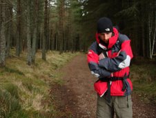
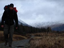
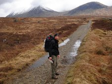
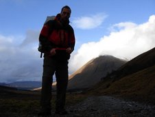
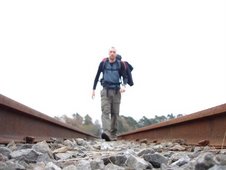
Wednesday 17th January 2007

Distance Walked: 21.5 miles
Start Time: 9:11
End Time: 15:54
Elapsed Time: 6:43
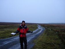
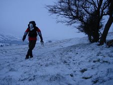
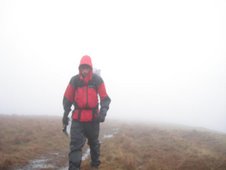
Weather: Grey. Cold. Miserable.
Distance walked so far: 62.7 miles

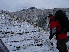
This is where the reality kicks in. Anyone can walk along a path for a couple of days. Not everyone can walk for day after day, when there is no path, along road edges, fields, moors, hills and mountains. That’s the challenge here, and it hits me almost immediately today. On a shitty grey day, I realise the value of preparation. Of paths. And maps.
You see, I don’t have a map for today’s route. I meant to get one, but I didn’t have the chance. And this causes problems.
Let me tell you about GPS devices. I bought a Garmin GPS device for this walk. The GPSmap 60CSx. It’s great. A neat little black gadget. It will tell me where I am and it will save me life. Of that I’m certain. What’s not great about it is that the digital maps that are supplied with it are so ridiculously basic that they are fundamentally unusable. You can however purchase, for a further £150, the Topo software which provides more detailed maps, for a limited area, to be downloaded to your device. You can also purchase the Memory-Map software which will allow you to pre-plan a route and export this to your device. The software for the whole of Britain costs £200. The device may save my life, but I was beginning to wonder whether that would be a wise financial investment. So I just went for the Memory-Map stuff. This means that I vaguely know which way I should be heading, without knowing precisely where I am or which road/path I should be following. This causes problems. And I experienced most of those problems today.
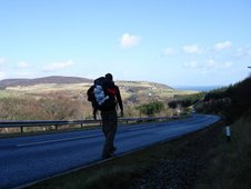
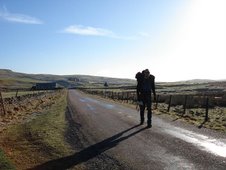
Today was spent pounding along tarmac, on a miserable wet day, walking on narrow Cornish lanes. With Cornish cars. And Cornish drivers. I felt completely unwanted. The only thing visible from Cornish Lanes are hedges and the occasional cow. The route suggested by McCloy mentions pleasant footpaths and country routes, but the footpaths that I found were impassable waterlogged bogs. Without an OS map I wasn’t entirely sure which country lane to take at each junction, and found myself dragged imperceptibly towards the foreboding A30. The A30 is a great road. Ploughing straight through the heart of Devon and Cornwall ,it plunges right to the very tip of the country; miles of slick, unadulterated, smooth tarmac, taming the wild moors and hills that surround it. It must be bliss for the end-to-enders who choose to travel on wheels. For walkers it is a constant torment. All surrounding roads are sucked towards it, and it is virtually impossible to avoid crossing it an some point of the walk. It's a constant reminder to the walker of the slow and antiquated progress they are making.
I finally worked out where I should be going but the necessary detour added unwanted mileage to the day and by the time I finally reached Truro my feet felt completely flattened. I wearily admired the cathedral, though fittingly it is encroached on all sides by a ghastly collection of shops and distasteful concrete monstrostities. The Phones 4 U salesmen next door are the modern clergy. Maybe if the Church rebranded as the ChristFaith Warehouse they'd start pulling in the punters again.
Booking a B&B through the Tourist Information Centre, I also purchased as many of the relevant OS maps that I could find and spent the evening tending to my aching joints and planning the route for tomorrow. I don’t mind walking, but it’s the meaningless extra miles that really get me down.
You see, I don’t have a map for today’s route. I meant to get one, but I didn’t have the chance. And this causes problems.
Let me tell you about GPS devices. I bought a Garmin GPS device for this walk. The GPSmap 60CSx. It’s great. A neat little black gadget. It will tell me where I am and it will save me life. Of that I’m certain. What’s not great about it is that the digital maps that are supplied with it are so ridiculously basic that they are fundamentally unusable. You can however purchase, for a further £150, the Topo software which provides more detailed maps, for a limited area, to be downloaded to your device. You can also purchase the Memory-Map software which will allow you to pre-plan a route and export this to your device. The software for the whole of Britain costs £200. The device may save my life, but I was beginning to wonder whether that would be a wise financial investment. So I just went for the Memory-Map stuff. This means that I vaguely know which way I should be heading, without knowing precisely where I am or which road/path I should be following. This causes problems. And I experienced most of those problems today.
Today was spent pounding along tarmac, on a miserable wet day, walking on narrow Cornish lanes. With Cornish cars. And Cornish drivers. I felt completely unwanted. The only thing visible from Cornish Lanes are hedges and the occasional cow. The route suggested by McCloy mentions pleasant footpaths and country routes, but the footpaths that I found were impassable waterlogged bogs. Without an OS map I wasn’t entirely sure which country lane to take at each junction, and found myself dragged imperceptibly towards the foreboding A30. The A30 is a great road. Ploughing straight through the heart of Devon and Cornwall ,it plunges right to the very tip of the country; miles of slick, unadulterated, smooth tarmac, taming the wild moors and hills that surround it. It must be bliss for the end-to-enders who choose to travel on wheels. For walkers it is a constant torment. All surrounding roads are sucked towards it, and it is virtually impossible to avoid crossing it an some point of the walk. It's a constant reminder to the walker of the slow and antiquated progress they are making.
I finally worked out where I should be going but the necessary detour added unwanted mileage to the day and by the time I finally reached Truro my feet felt completely flattened. I wearily admired the cathedral, though fittingly it is encroached on all sides by a ghastly collection of shops and distasteful concrete monstrostities. The Phones 4 U salesmen next door are the modern clergy. Maybe if the Church rebranded as the ChristFaith Warehouse they'd start pulling in the punters again.
Booking a B&B through the Tourist Information Centre, I also purchased as many of the relevant OS maps that I could find and spent the evening tending to my aching joints and planning the route for tomorrow. I don’t mind walking, but it’s the meaningless extra miles that really get me down.

Song of the day:
Andrew Bird
“Headsoak”
I was walking /
I was walking /
With my feet /
A disposition /
A disposition /
Fell over me


No comments:
Post a Comment